Finding Coordinate Midpoints
Introduction
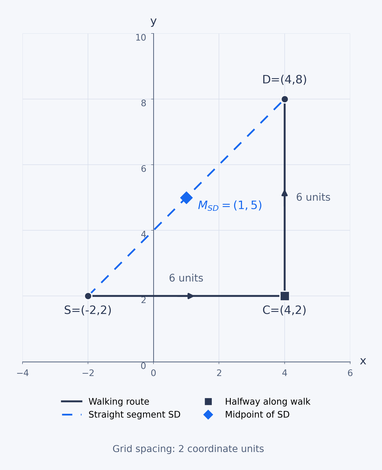
In this second lesson of Coordinate Skills in the Real World, you’ll use coordinates from a map to find an exact meeting point. The previous lesson showed you how to read locations from labeled grids; now you’ll find the midpoint of a straight segment and distinguish it from halfway along a walking route that turns.
What Does Halfway Mean?
Suppose two bus stops are joined by a single straight segment. The segment’s midpoint lies on it and is the same distance from both endpoints.
For a route with a corner, halfway means traveling half the route’s total length while following each leg. That location may not be the midpoint of the straight segment between the route’s start and finish.
Read the Endpoint Coordinates
Before calculating, read each endpoint as an ordered pair from the map’s labels, using the interval-and-subdivision method from Lesson 1 if needed. The grid interval is already in coordinate units: if a stated step is 2, moving one space changes a coordinate by 2, not 1. Once you have the exact endpoint pairs, work from those values instead of estimating from the drawing.
Find the Midpoint of a Straight Segment
To find the midpoint, average the two -coordinates and average the two -coordinates. For a segment from to , the midpoint is:
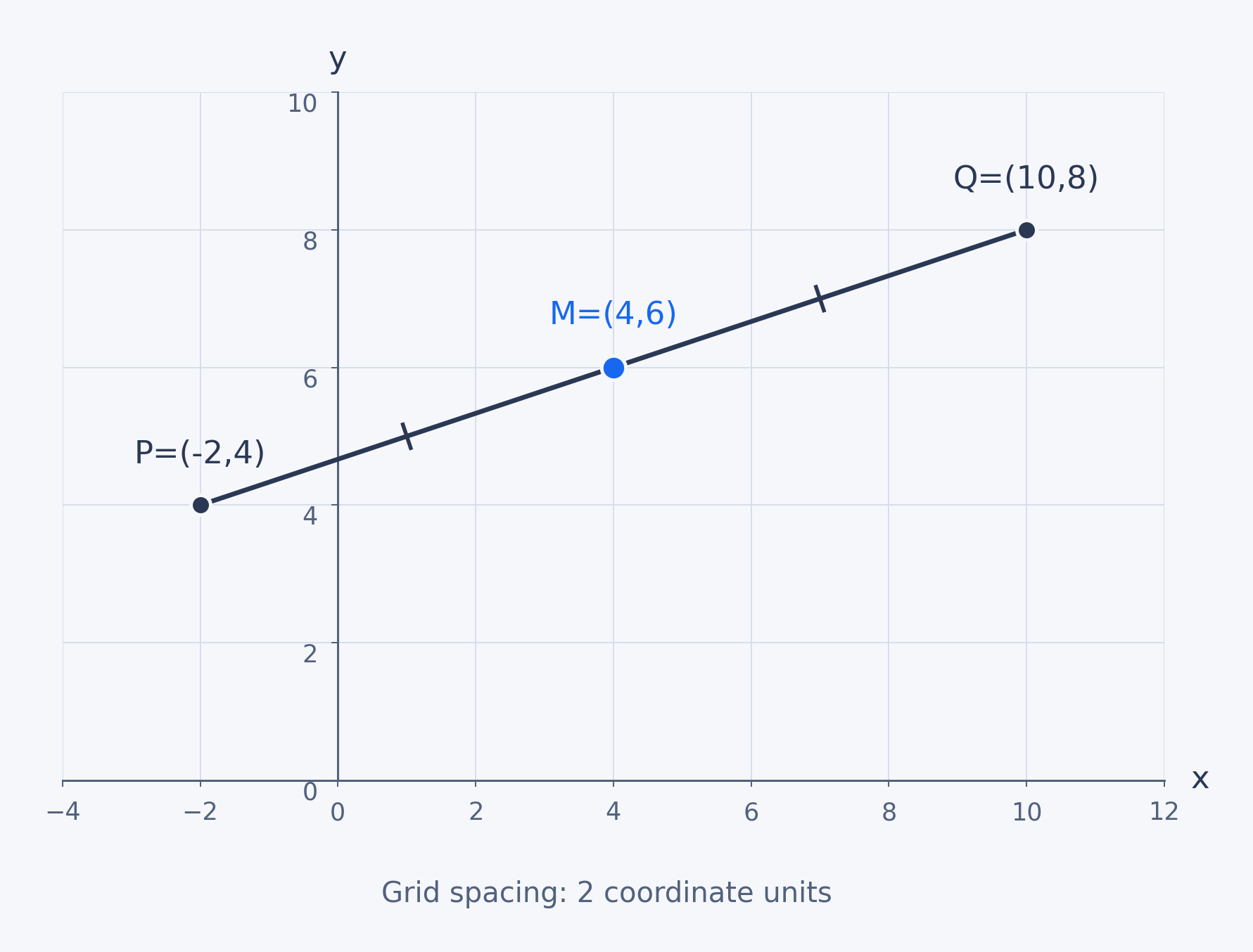
Suppose bus stops and are on a map whose grid marks are 2 coordinate units apart on both axes. Their midpoint is:
From to and from to , the changes are in and in for each half. Since the changes match, is the midpoint of the straight segment .
A Bent Route Has a Different Halfway Point